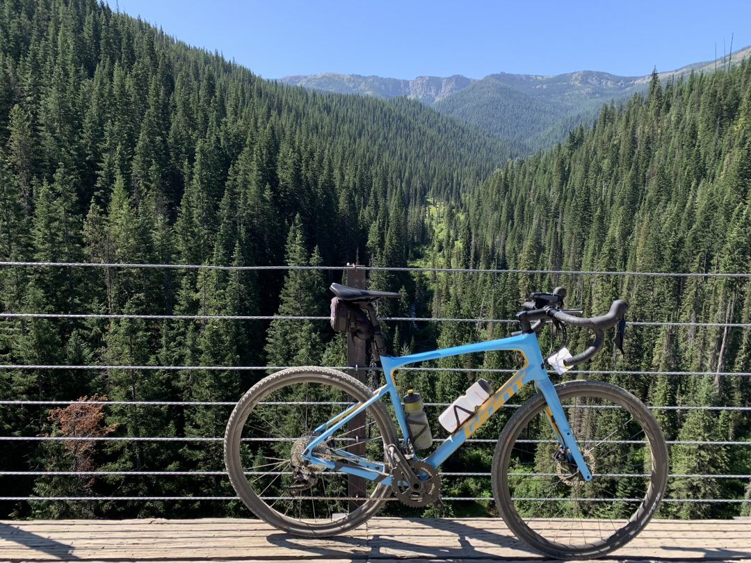
13 miles of cycling is nothing for Doug so our relaxed ride in Coeur d’Alene (see our review here) was followed by a 22 mile round trip ride on the scenic Hiawatha Trail (www.ridethehiawatha.com) .
Leaving Coeur d’Alene in the late afternoon we headed east on Hwy I90 through the picturesque restored mining town of Wallace and then about 7 miles past the Lookout Pass Ski Area and the Montana border. At the “town” of Taft we headed into the mountains on Forest Service Road 506 for about 3 miles to the “East Portal” where we found the large parking lot and ticket tent for the start of the Hiawatha Trail where we would begin our ride the following day. We ended up boondocking that night about a mile beyond the Hiawatha starting point in a pullout just off the forest service road. It was eerily isolated but made for a quiet night’s sleep and a very short drive for our adventure the next morning!
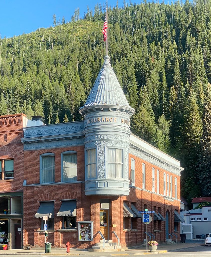
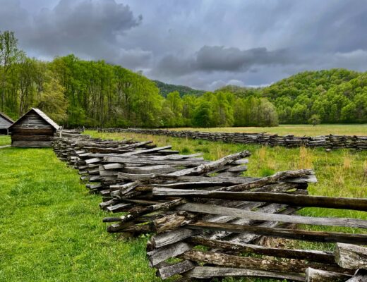
Wallace 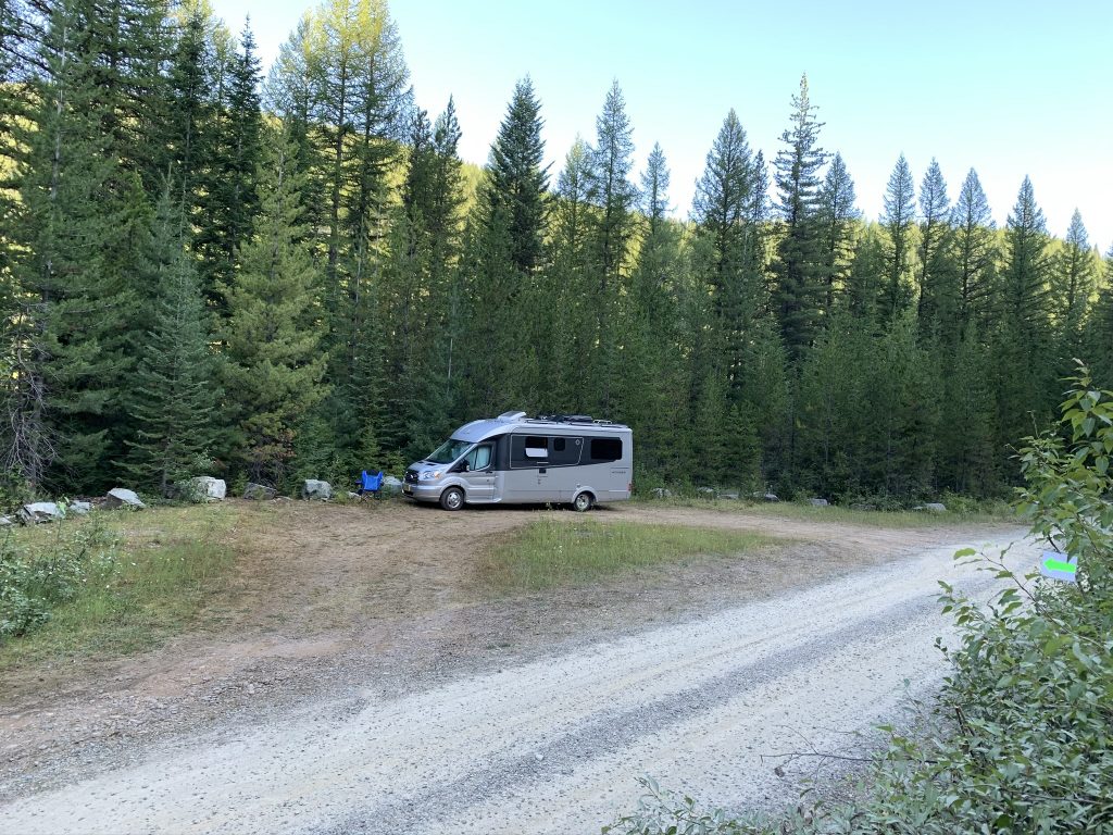
Boondocking
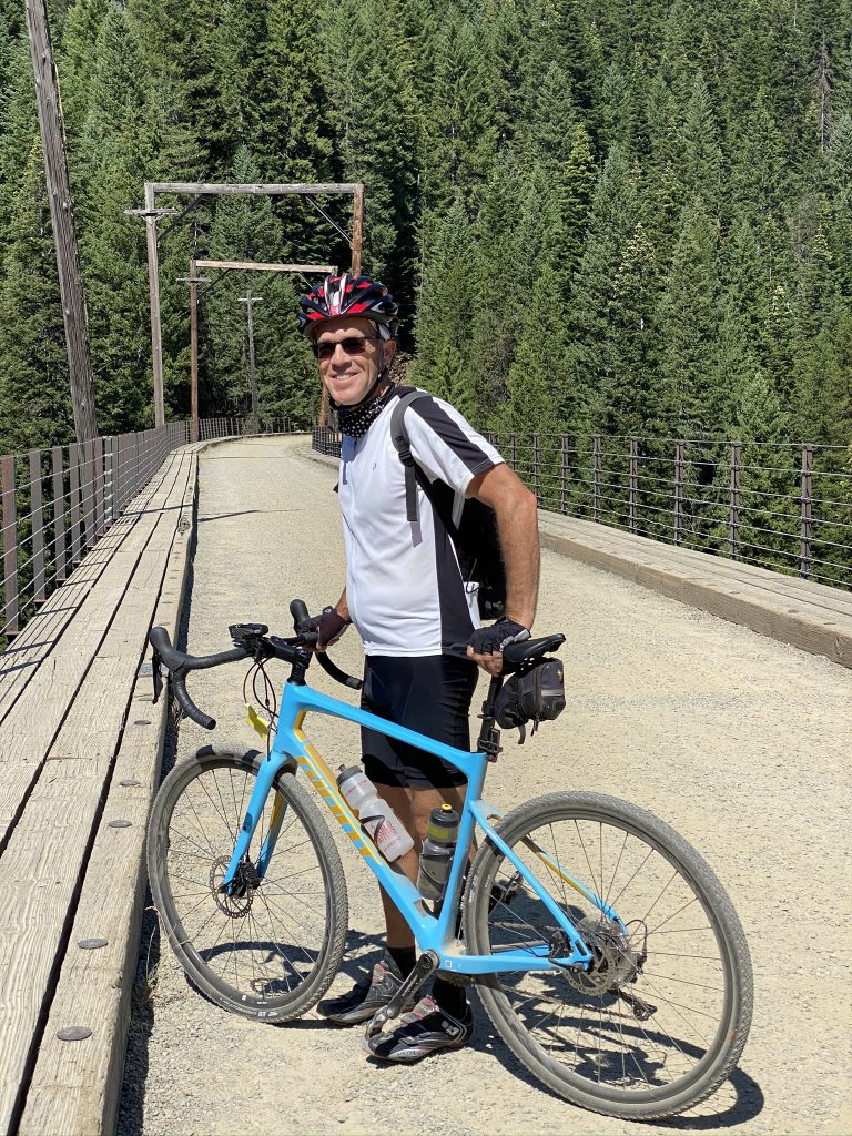
The Hiawatha Trail began as a part of the Intercontinental Railroad that ran from Chicago to Seattle in the early 1900s. This stretch was known as one of the most scenic in the country. The railroad closed in 1980 and was abandoned. The 15 mile rail-to-trail opened in 1988 and passes through 10 train tunnels and 7 trestle bridges. A trail pass costs $13 per person which can be purchased at the trailhead.
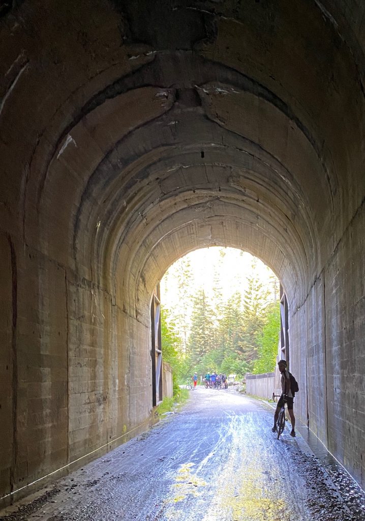
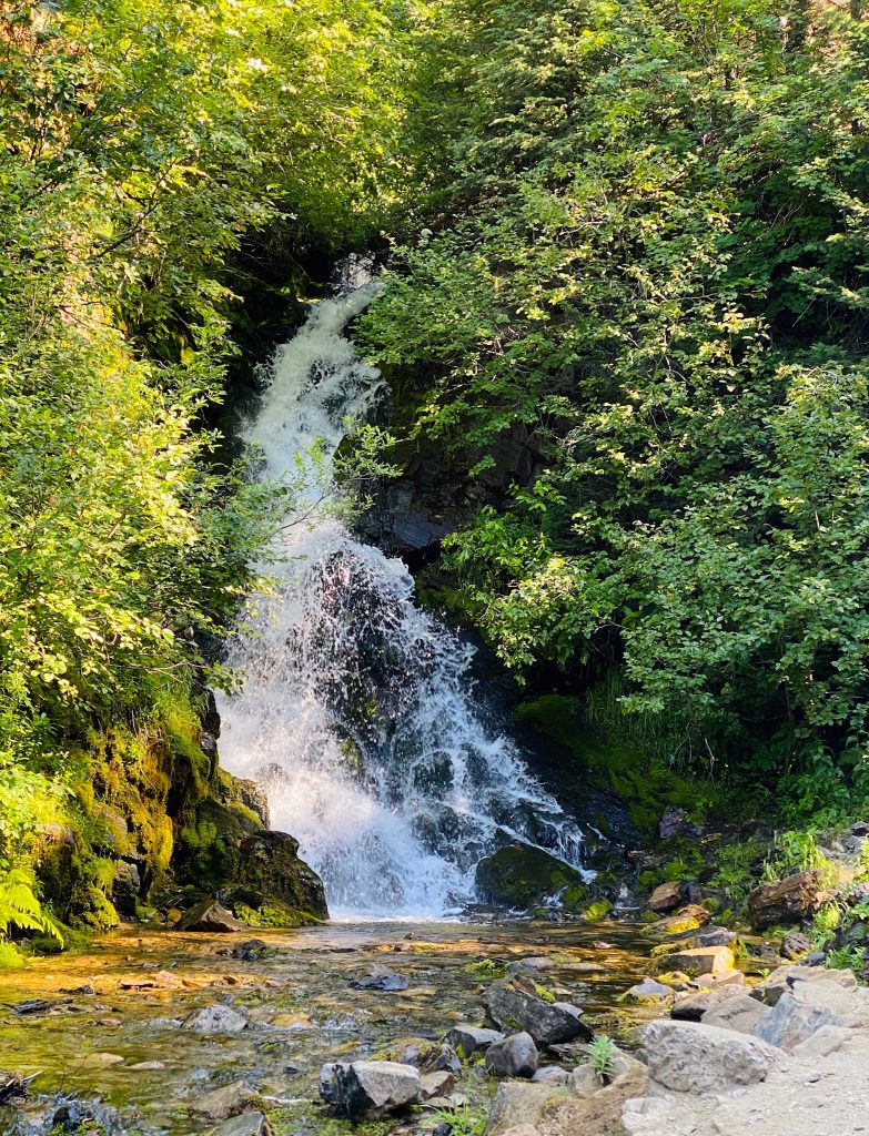
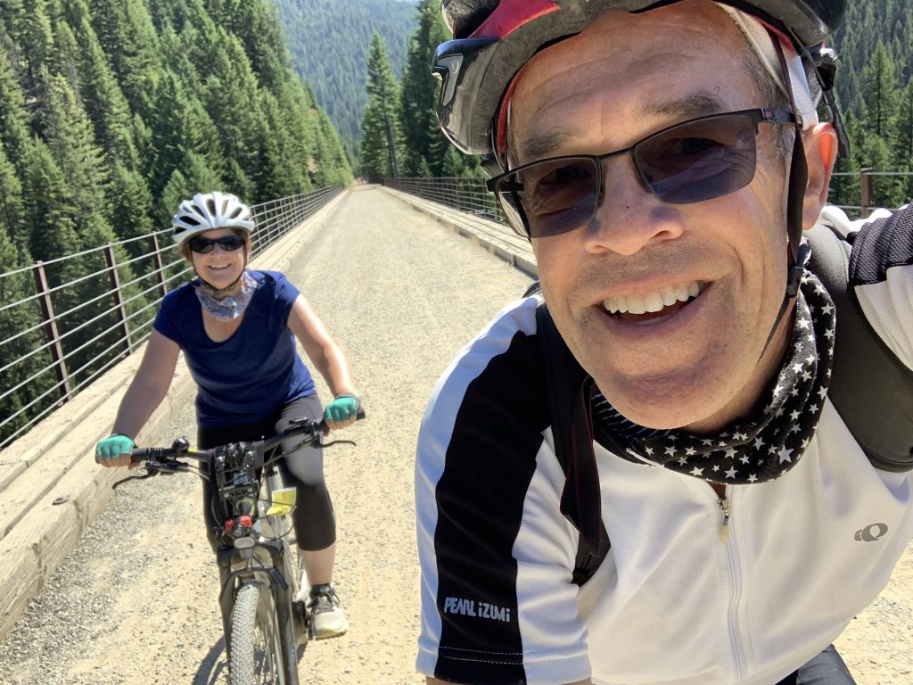
The thrilling bike ride begins with you turning on your bike headlight as you roll downhill and then through a cavernous, pitch black, damp, dripping, over 1.6 mile long train tunnel called the Taft Tunnel. When you’re biking though it, it’s easy to forget that no trains will be headed your way and we kept expecting a huge light to blind us with the whistle of the train. Emerging from this tunnel that passes under the Bitteroot Mountains and the Idaho-Montana state line, you’re thrown into gleaming sunlight and past a pristine waterfall. What a great start to the day!
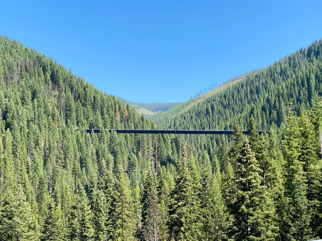
There are 9 more tunnels and 7 trestles on the trail. During the ride you look down upon the winding trail, the distant creeks (Cliff, Loop and Clear Creek), and several of the trestle bridges of the route. Two of the trestles are particularly spectacular at a dizzying 200 plus feet above the creeks below!
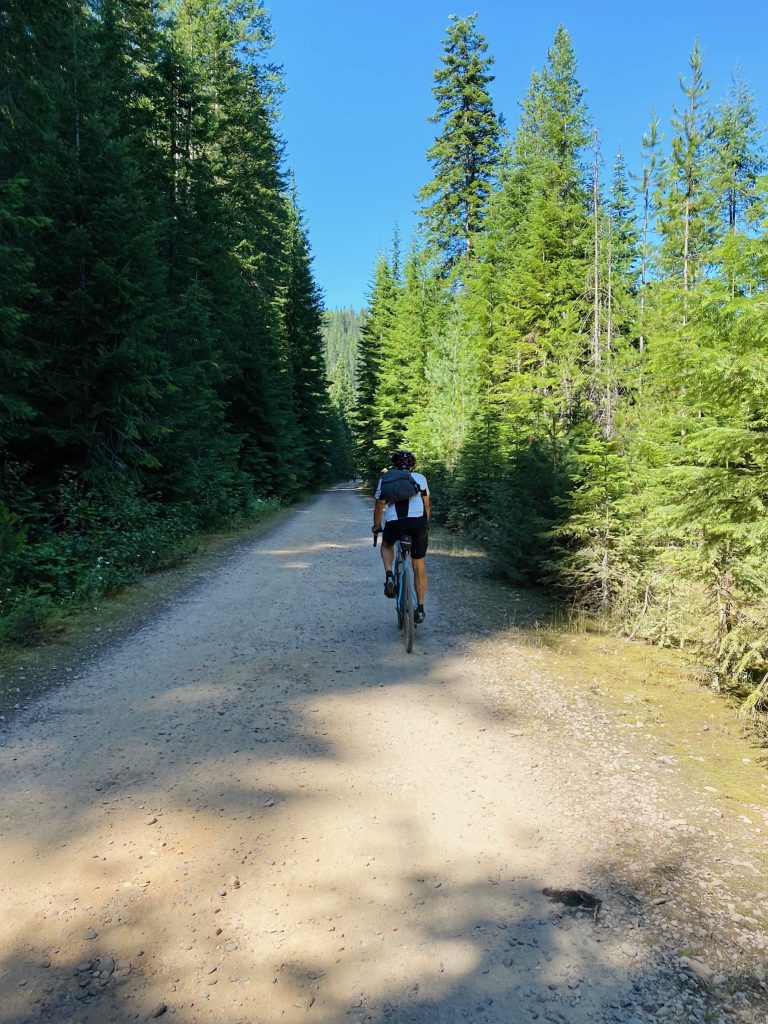
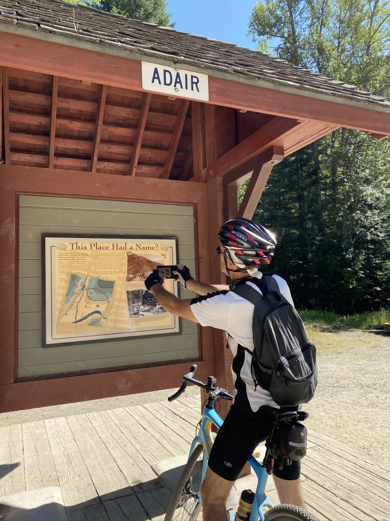
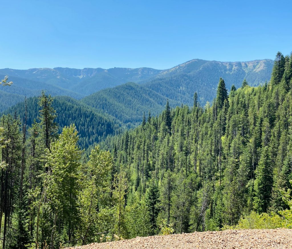
Up close, the Bitteroot Mountains are blanketed with pretty wildflowers that sit under tall fir and pines. Rocky outcroppings pop along the surface. From a distance, it’s a sea of uniform forest green trees and layer upon layer of mountains that change from deep forest to blue to navy and deep purple in the distance. Sometimes the trail runs through dainty meadows as well. This great scenery is matched with fascinating interpretive story boards along the route that provide a full history of the development of the rail route.
The entire trail is unpaved gravel but being a railway grade, it maintains a 1.6% to 2% downhill slope most of the way, making it easy for anyone, including families, to complete.
We went 11 miles down and then turned around just past the last trestle to ride back up to the starting point, but there is also an option to go the full 15 miles down and pay for a bus ride back to the top / parking lot. You can bring your own bike or rent them from the Lookout Pass Ski Area and apparently have them delivered to the East Portal parking lot to start. Helmets and lights are required in any case.
We suspect that all of the rails to trails rides provide unique experiences because some of them also pass through tunnels and over bridges – and our appetite was whetted to return to explore some of the other trails in the future – but we can definitely vouch for this one in particular as a do not miss for the magnificent scenery!