Doug grew up knowing the beauty of the Cascade mountains and I grew up knowing the Rockies but neither of us expected South Dakota’s Black Hills to be so incredible. This may be why we seriously underestimated the time to spend in this area. What should have been a minimum of a week to just sample the area we sampled in just 4 long days in late August of 2020!
I’d highly recommend the area and all the places on this itinerary but not rushed through in 4 days.
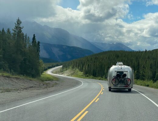
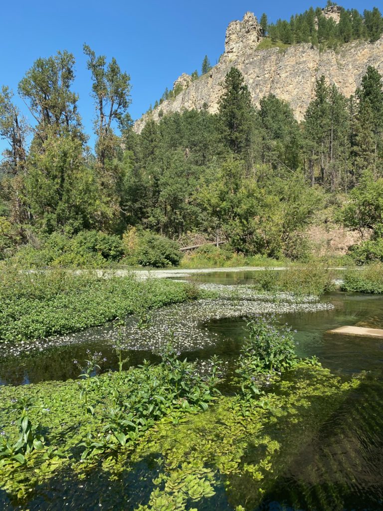
From Devil’s Tower in Wyoming, we dropped pretty far south through Newcastle to head towards South Dakota. The drive is full of green, vast open spaces and pronghorn. The drive along Hwy 85 is stunning! The road follows Cold Spring Creek as it winds through gorgeous woodlands and massive rock sculptures perched like gargoyles near the mountain tops. Our destination was a little campground in the northern part of the Black Hills National Forest. We arrived at Hanna Campground a little after dark and thus missed some of the beauty which I’m anxious to get back to.
DAY 1
- Spearfish Falls hike
- Roughlock Falls hike
- Spearfish Canyon drive
- Devil’s Bathtub walk
- Rushmore visit
- Crazy Horse Memorial visit and light show
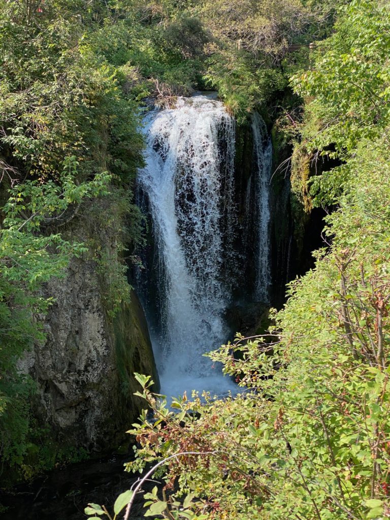
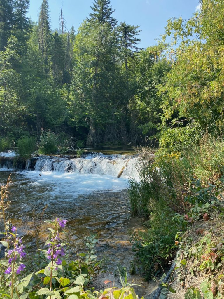
From our campsite the next morning we drove towards Savoy on 14 following Spearfish Creek and the Spearfish Canyon Scenic Byway. The weather was perfect for two morning waterfall hikes. The first was a highly groomed 1.6 mile looped trail to Spearfish Falls. I’ve never seen tree trunks as multi-colored as those that line this path and the light mist off the pool from the waterfall was particularly nice but I don’t think these pictures do either justice.
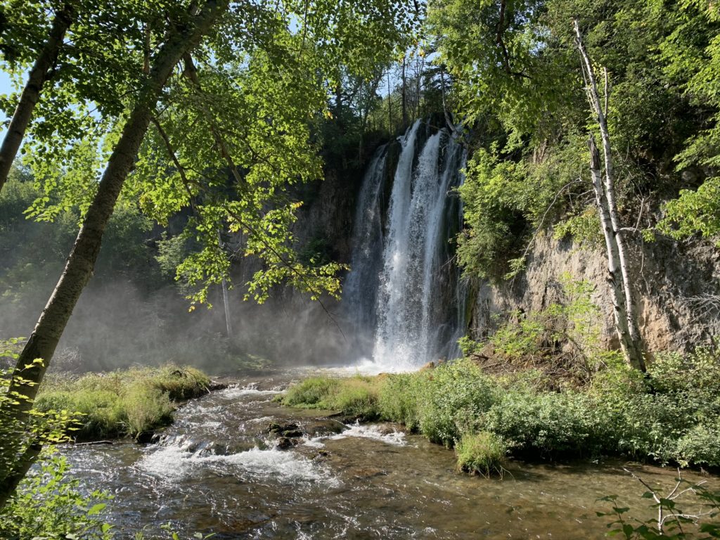
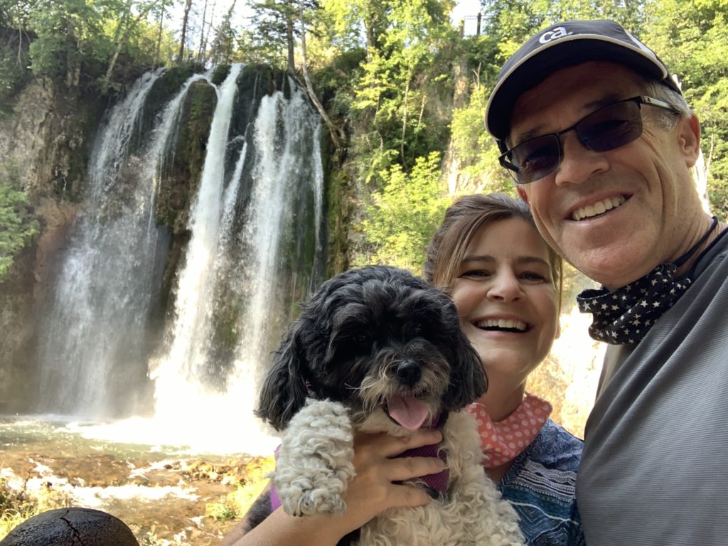
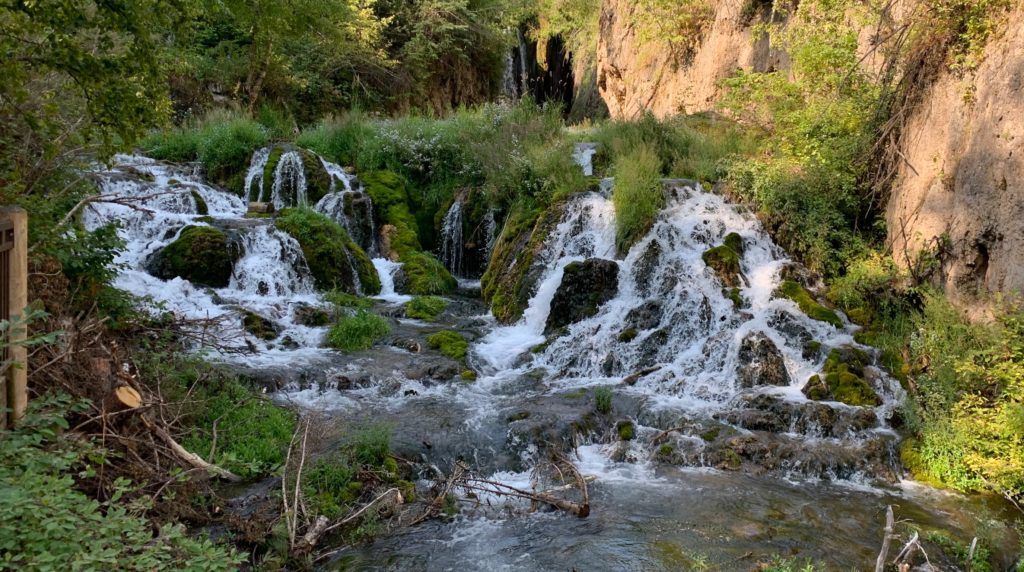
After the first waterfall I was already in my happy place but I’m glad we didn’t just move on as the second 1 mile out and back hike has beautiful scenery along the way and culminates in an upper falls but an even more beautiful lower falls with multiple cascades that creates one of most beautiful locations we’ve seen to date. Roughlock Falls Trail and waterfall cannot be missed!
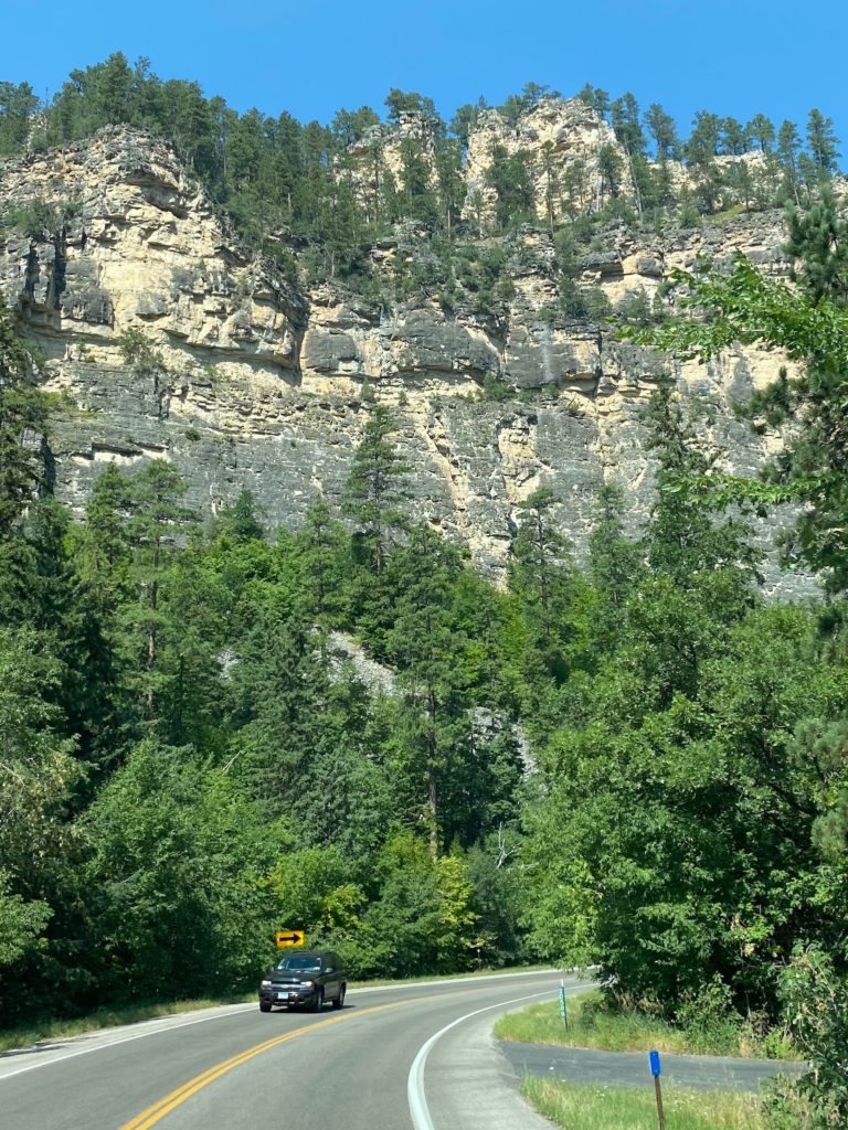
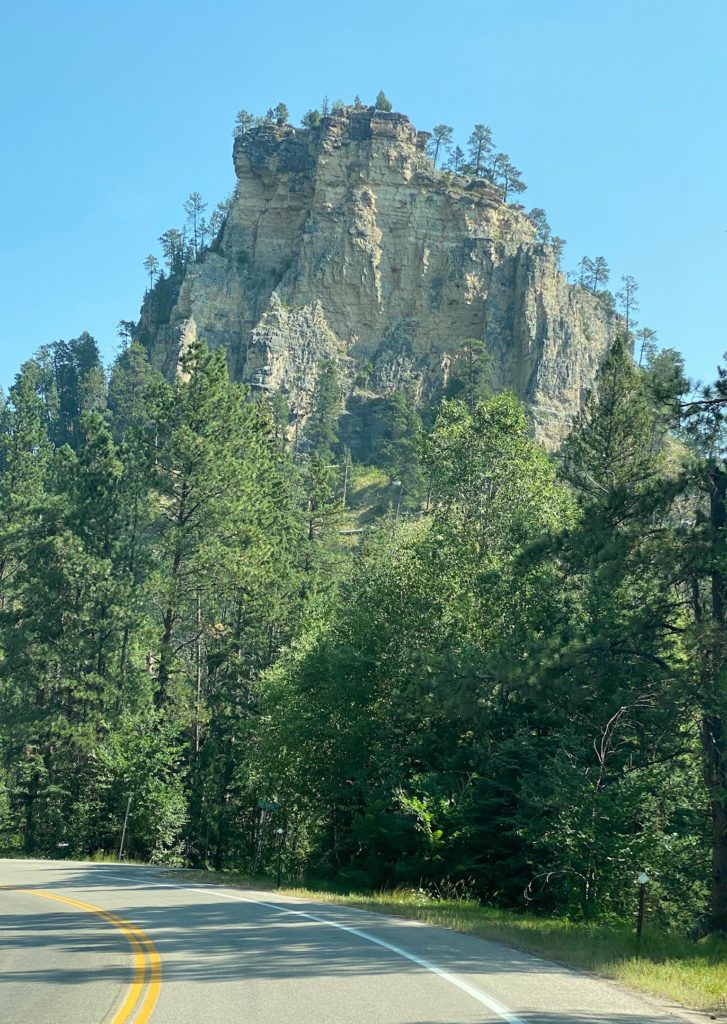
From Savoy we continued our drive northeast on 14 where I nearly had whiplash from the canyon drive to Spearfish – looking left, looking right, then back left again! More of those gigantic perched rocks atop lush forested hills. We stretched our legs at Devil’s Bathtub and continued on our journey
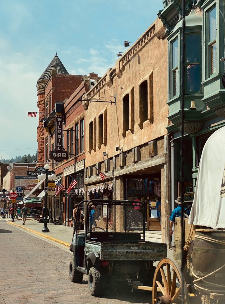
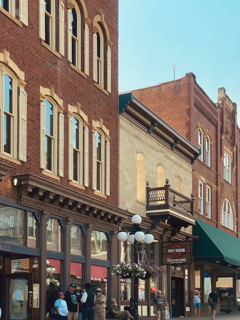
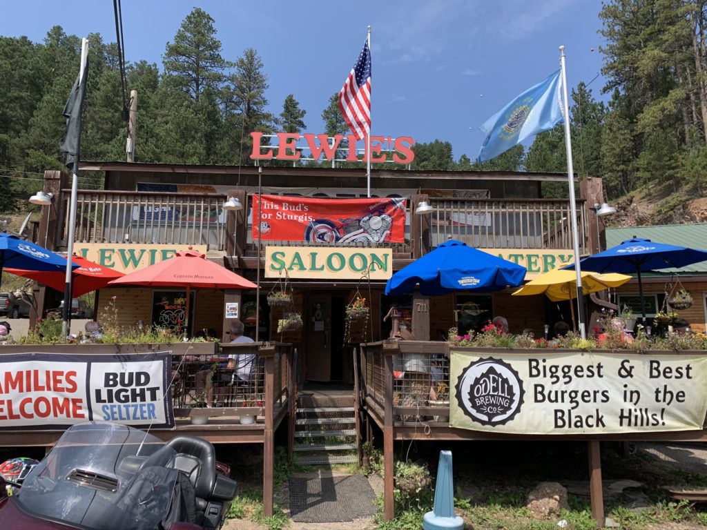
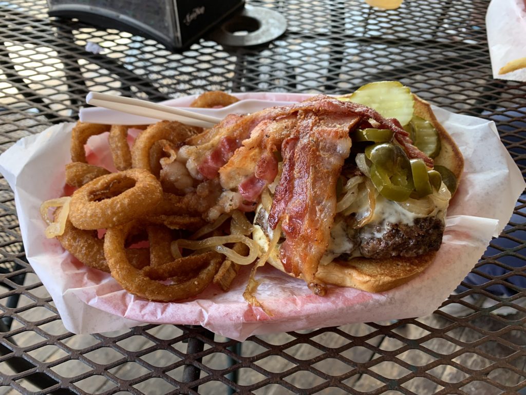
We really wanted to stop in several of the next towns but we pushed on with more on the day’s agenda. We bypassed Spearfish turned east and then headed south towards Deadwood. Deadwood was hopping…this chic western town has beautiful little boutiques, bars and restaurants. Oh…to have another day! We finally stopped in Lead for a quick lunch at a classic biker burger place and then headed on to our end game, the piece de resistance, Mt. Rushmore!
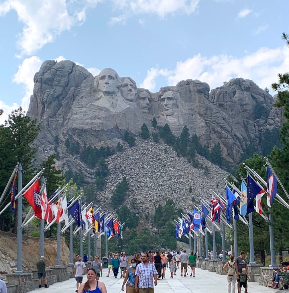
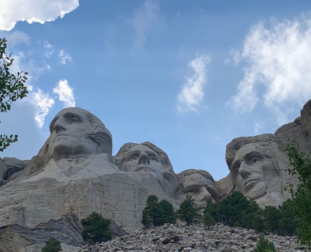
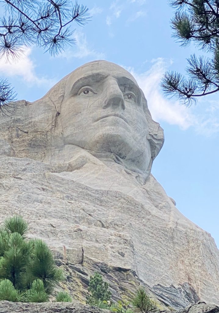
We’ve all seen pictures of these presidential greats (Washington, Jefferson, Roosevelt, and Lincoln representing our country’s birth, growth, development, and preservation) carved into the side of the mountain but, being there is more about the feeling. The approach through the Avenue of Flags and the pillars under each one with information about the date it joined the union reminds you how unique our nation is. This country, like no other, established by a government balancing federal and state rights forming a perfect union…you feel patriotic and proud. As you move closer and closer to the presidents you’re struck not only by their size (those heads are 6 stories tall), precision, and beauty but also by the people represented…their values, their sacrifice and their service to our country. It may look kitschy on a post-card but don’t pass up the opportunity to see Mt. Rushmore as close as possible. The visitor center is a wealth of information about the process used to create this monument and the man in charge, astounding. There’s also a lot of information about why each president was chosen. I could write an entire post on this stop alone but like this trip, I must push on.
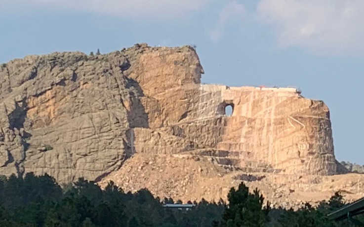
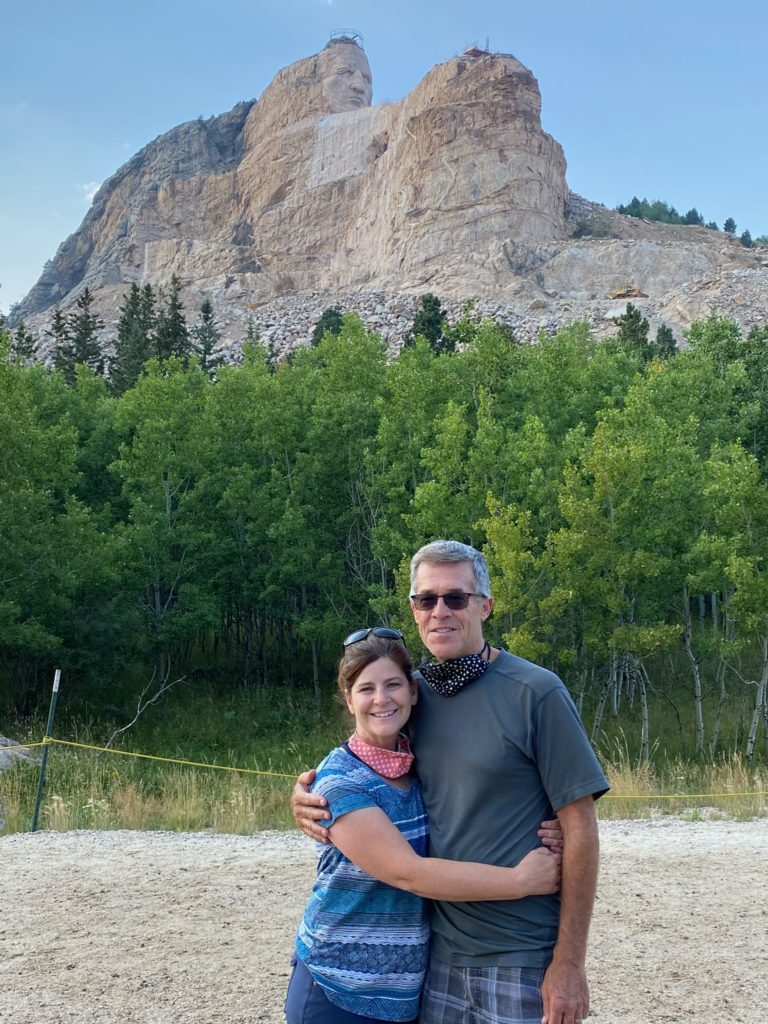
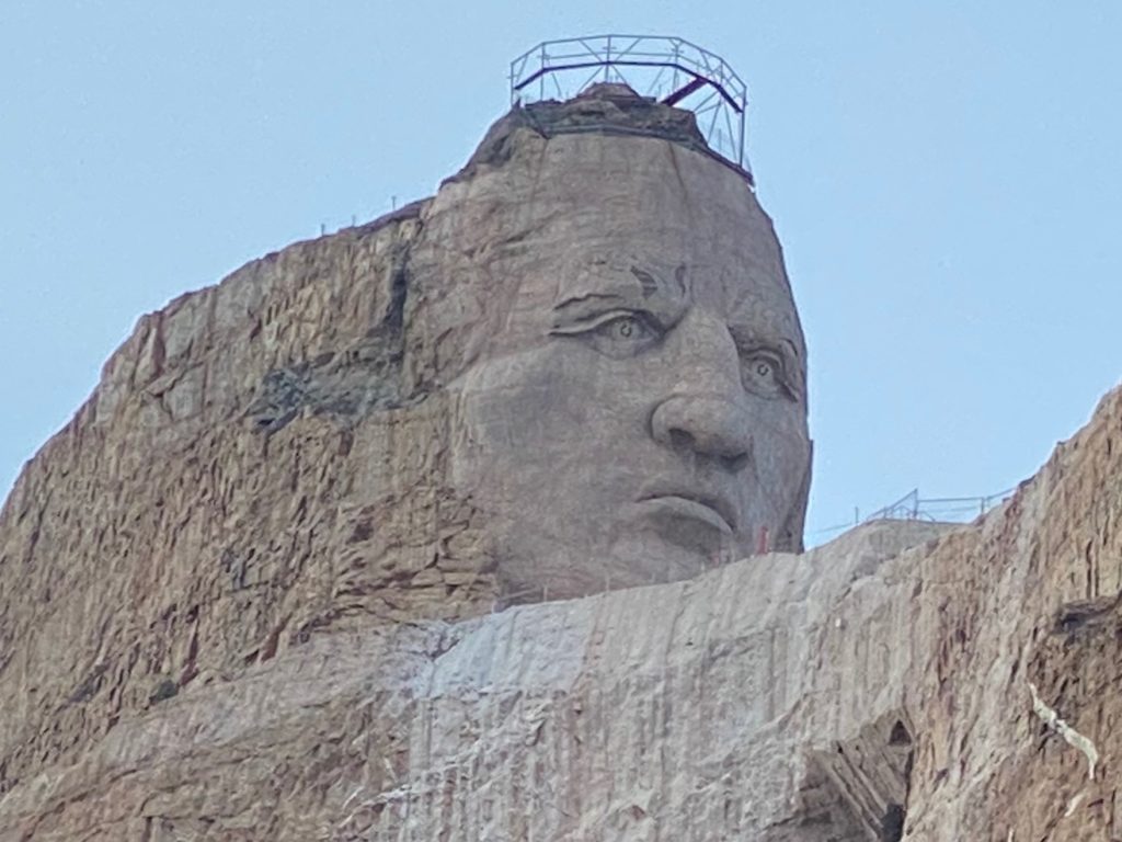
By the end of our Mt. Rushmore visit, it was late in the afternoon, but Crazy Horse Memorial was so close and we were told there was a good evening laser light show so we sped over. We paid the extra fee to take the bus to the base of the Crazy Horse sculpture and it was well worth it. Crazy Horse’s head is 27ft taller than those of the Mt. Rushmore presidents and when the memorial is done it will be larger than all 4 president’s heads stacked one atop the other. Crazy Horse’s outstretched arm pointing to his land is 263ft long!
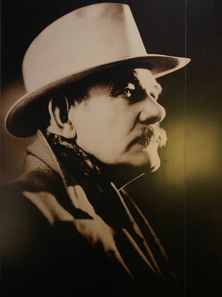
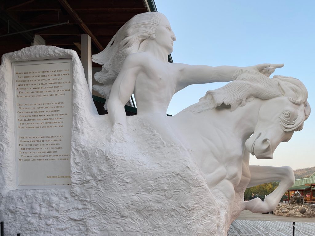
This is a monumental feat that was started in 1948 and after over 70 years of work is far from being complete, but they’re saying that with the latest technology being used to cut the rock they think it could be finished in JUST 80 more years. What’s already carved is beautiful and what is intended, even more so. The museum at this location provides a lot of information on the progress, how it’s carved, why it has taken so much longer due to the type of rock and the unwillingness to accept federal money as well as a lot about the artist, since deceased.
We ate dinner in the parking lot in our RV to stay for the lightshow.
TIP: Park in the upper parking lot closest to the Crazy Horse Monument to get the best view of the lightshow.
We found a boondocking spot just as the sun was setting. Whew! A whirlwind day!
Exhausted we fell into bed only to be woken by a thunderstorm with large marble sized hail. A similar storm the prior year in Billings with slightly larger hail did over $8K worth of bodywork damage to our car so as this hail crashed into the RV’s rooftop solar panels, I was imagining the worst! After a fitful night we got out to check the damage in the morning and were amazed that the RV had survived without any broken windows, damaged solar panels or body dents. Lucky us!
DAY 2:
- Sylvan Lake walk
- Iron Creek and Needles Eye Tunnel drive
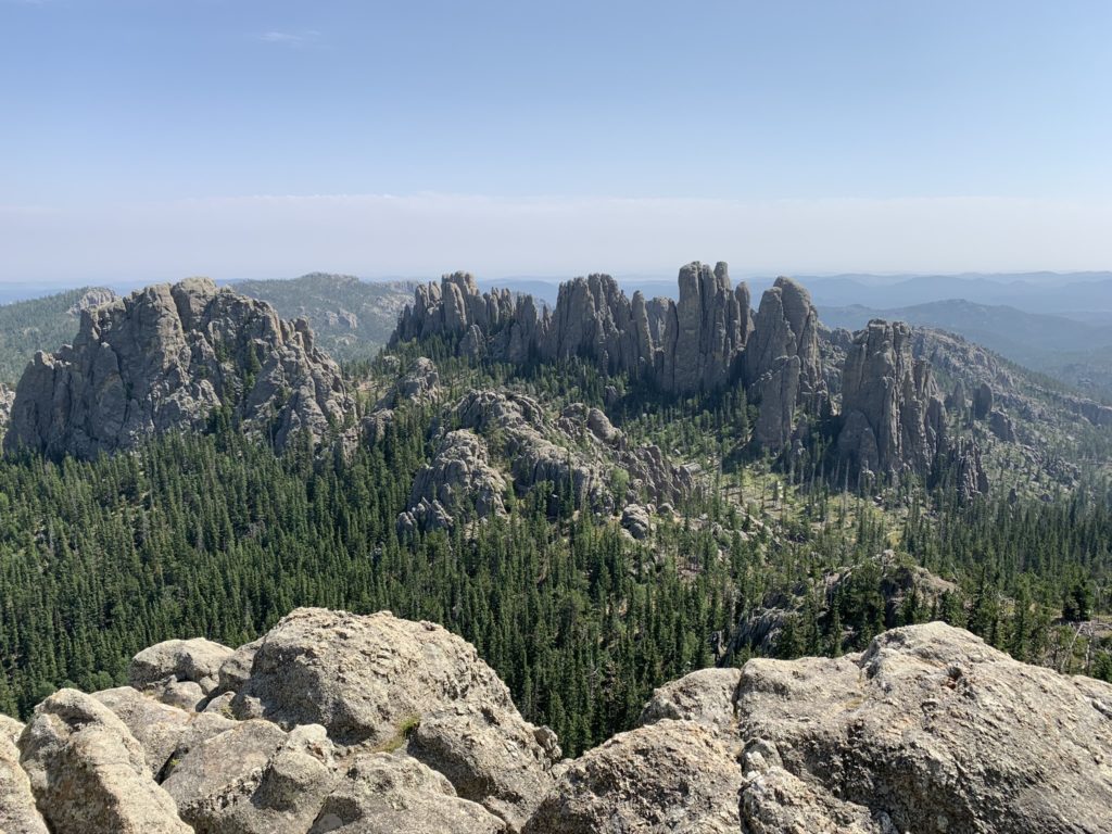
- Cathedral Spires and Little Devils Tower hike
- Wildlife Road drive in Custer State Park
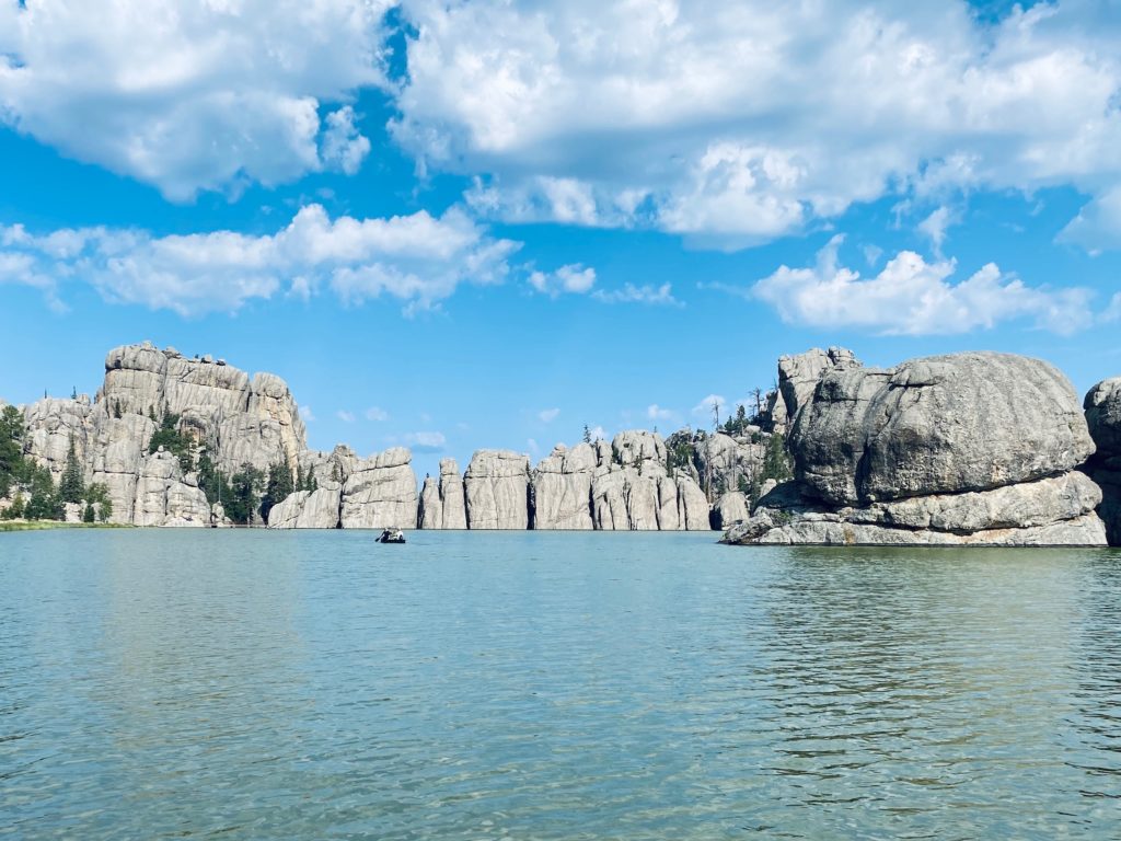
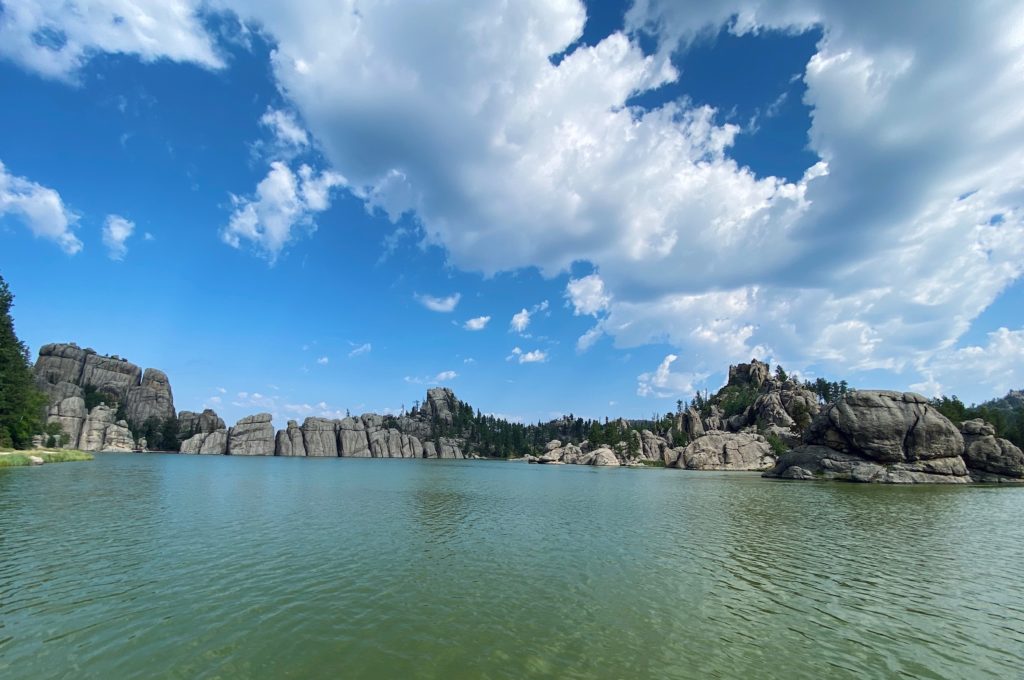
The next day we started our explorations of Custer State Park, beginning with a morning shoreline dog-walk around Sylvan Lake. This may be one of the most photographed lakes in the park and for good reason. On a sunny day the rock reflections in this pool are striking and on an overcast day it is brooding and mysterious! It’s also located near lodging, campsites, a general store, and they allow swimming and non-motorized boats in the lake. Parking is fairly limited, especially for RVs.

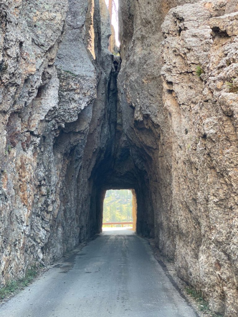
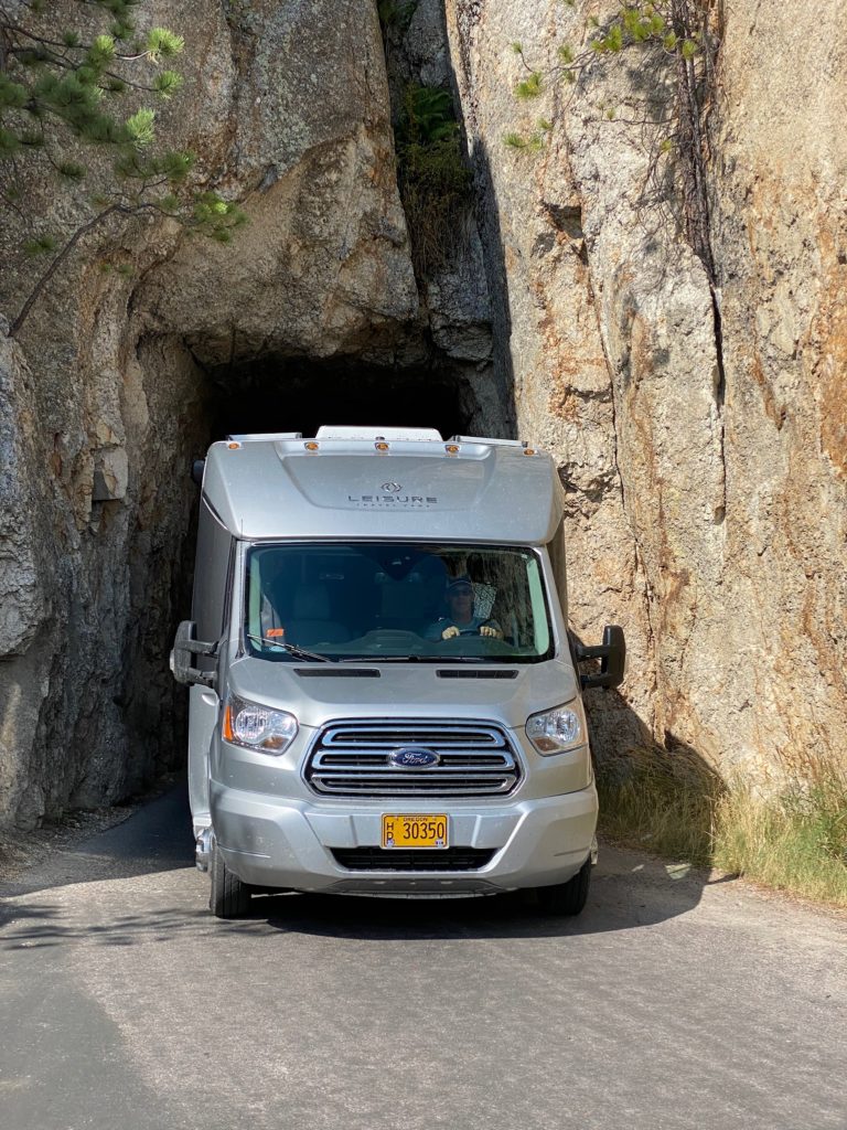
From there we zigzagged along narrow highway 87 through Iron Creek and Needles Eye Tunnels, which was a hair-raising experience in an RV. There are plenty of warnings about the size of these tunnels (Iron Creek is 11ft 4in tall and 9 ft wide and Needles Eye is the same height but only 8ft 4in wide) our RV was JUST small enough at 10ft tall and 8ft wide) to squeeze through…at times with both side mirrors pulled in…a bit like me pulling on skinny jeans between Thanksgiving and New Years – a tight fit, quite the challenge, and gratifying when its over!
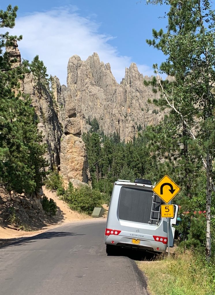
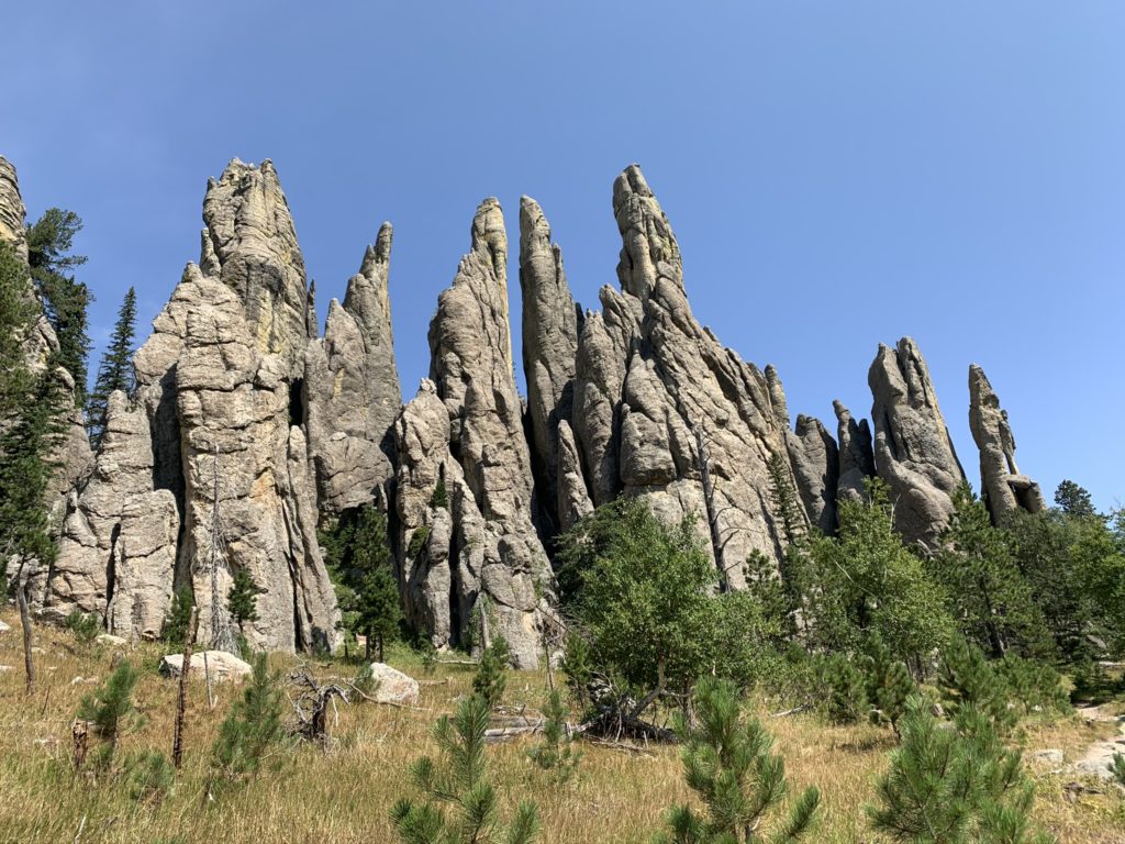
We wound our way to the trailhead at Cathedral Spires and this is sadly where we put the first ding in our RV. We scraped the top of the RV along the edge of a sign along the side of the road as Doug otherwise skillfully wedged the RV into one of the more challenging roadside parking spots of the trip.
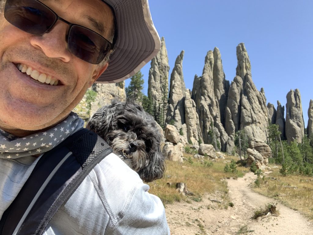
This trail is dog friendly but fairly rocky so we had to do some bouldering with Bailey in the pack as some of the rocks were a bit too tall for her 1ft frame. The 1.6mile out and back hike is moderate with little elevation gain. We packed a lunch and the spires made for a perfect backdrop. Doug went a little further on the trail to Little Devils Tower with a run back to catch up with Bailey and I just before we returned to the parked RV.
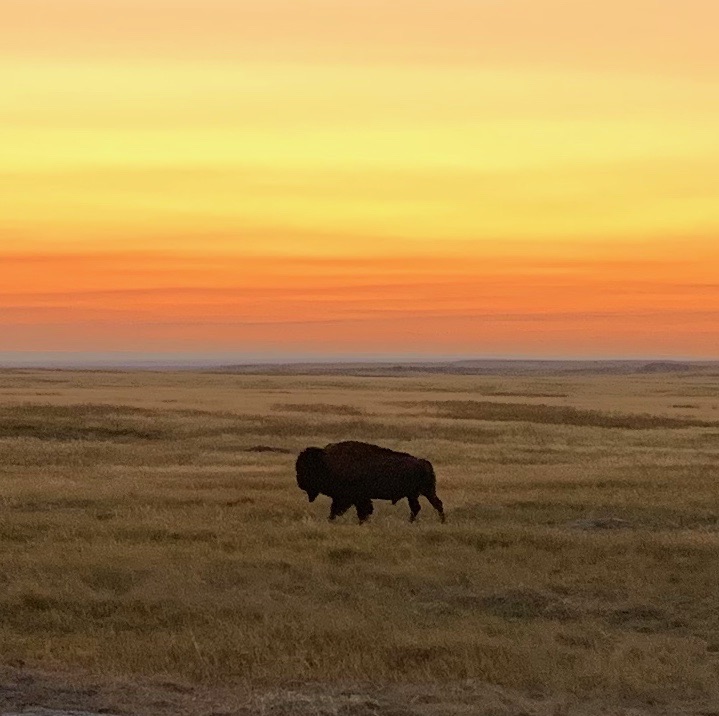
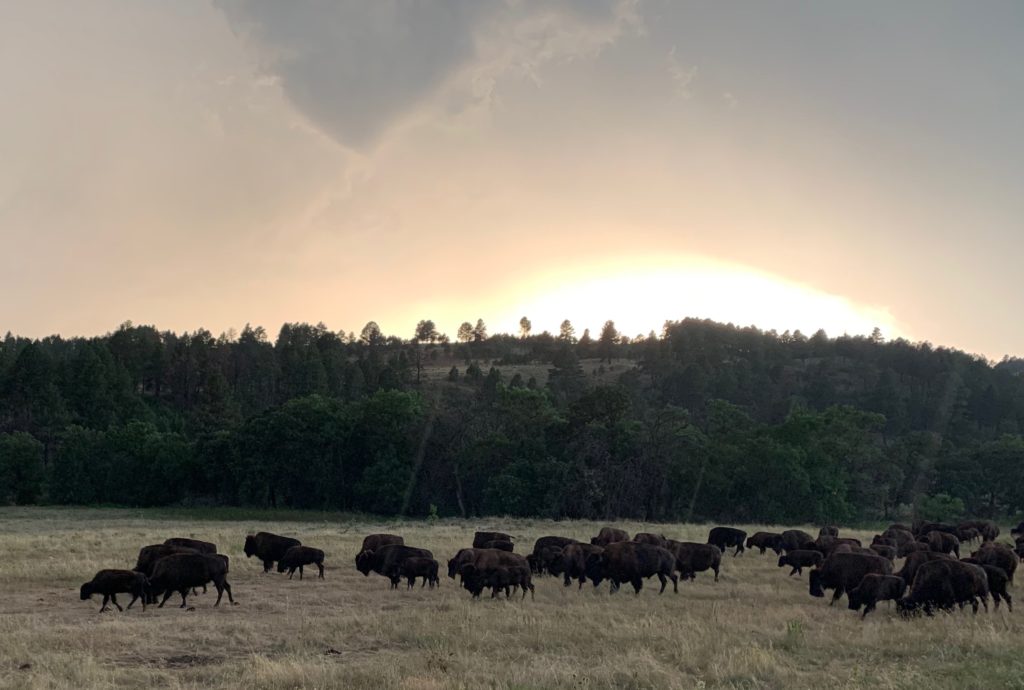
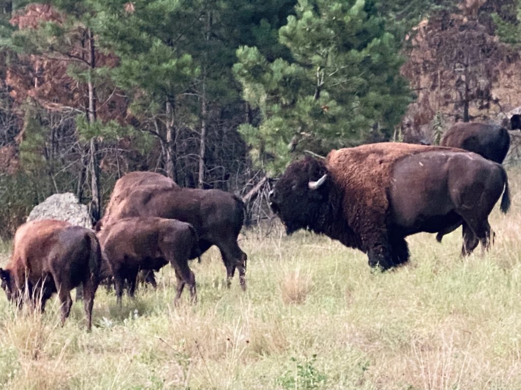
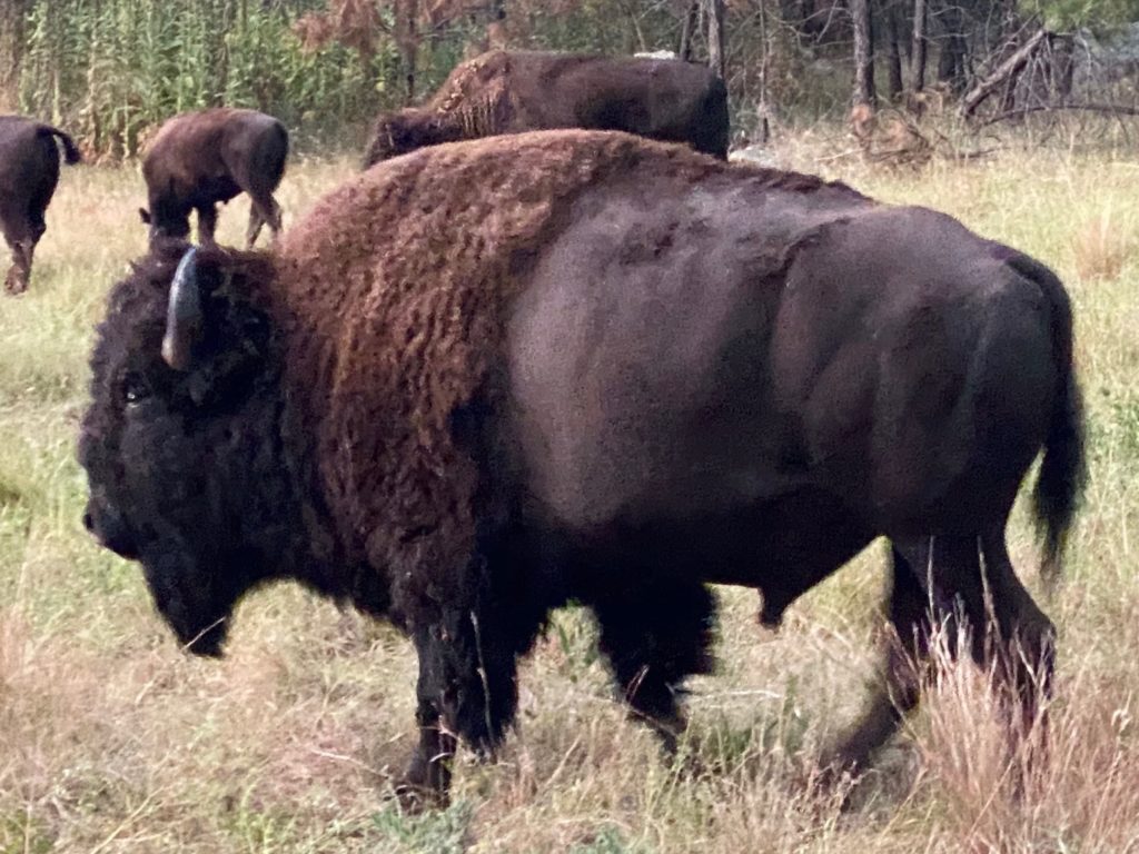
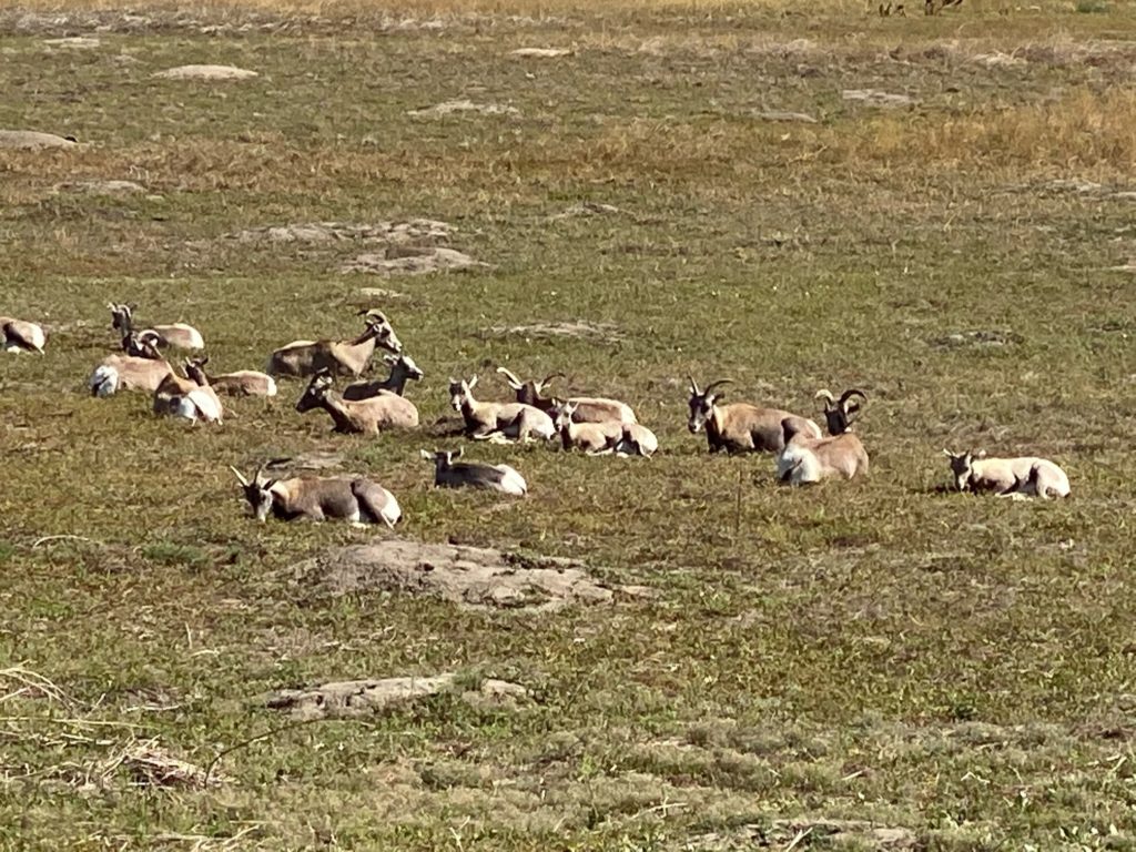
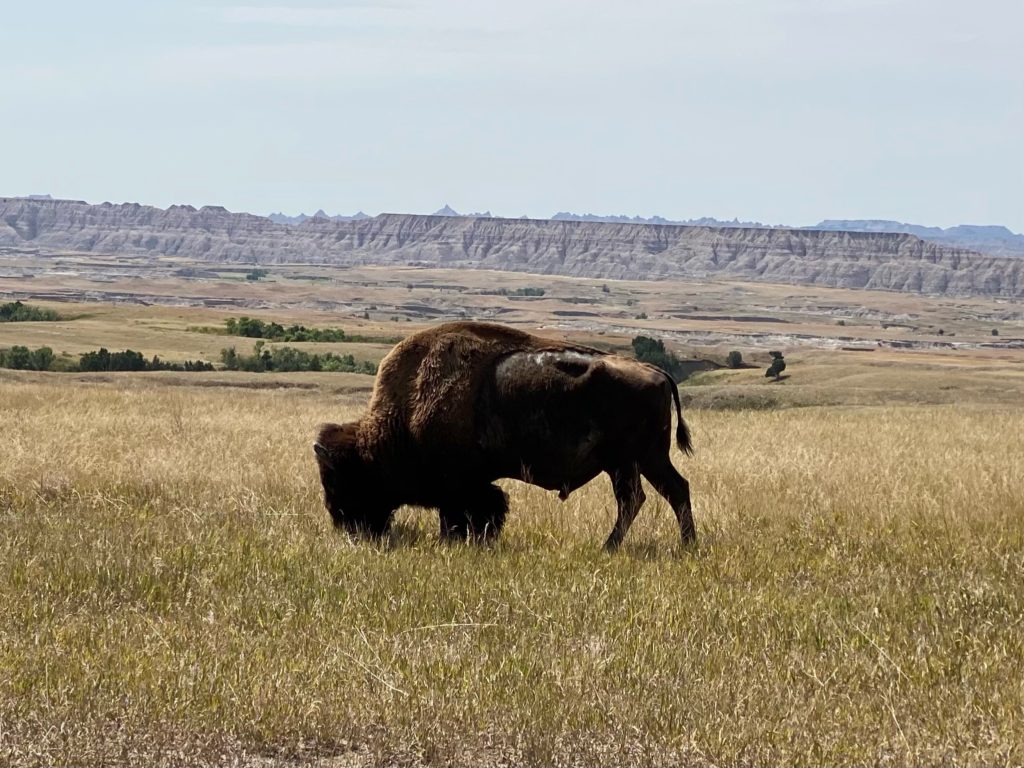
Overlooks from Hwy 87 were spectacular as we cut off and headed east on 16A towards State Game Lodge Campground in Custer State Park for the night. After checking in and grabbing a quick bite to eat, and despite the rain and lightning in the distance, we ventured out around dusk to drive the Wildlife Loop Road. This 18 mile loop through open grasslands and pine-speckled hills is home to pronghorn, deer, and bison. We made our way mostly around the loop without seeing much wildlife but enjoyed the spectacle of the thunderstorm moving through in the distance with lighting strikes over the plains. In the final few miles of the drive we finally encountered a large herd of bison by (and on) the road. The large herd with the thunder and lightning in the background made for quite the scene!
DAY 3:
- Rapid City lunch
- Wall Drug visit
- Pinnacle Overlook bike ride into Badlands Park
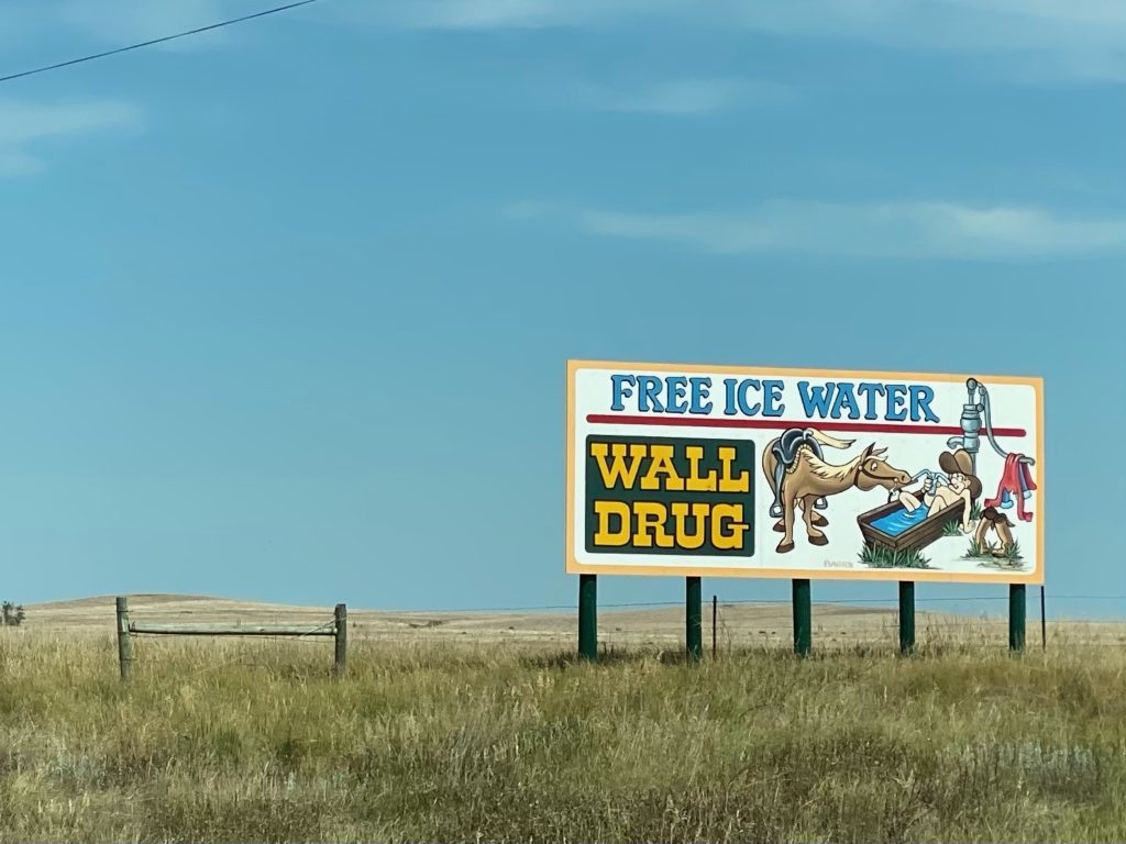
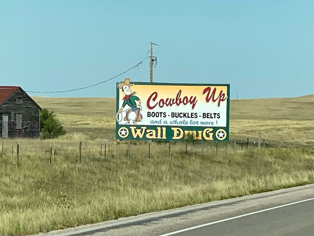
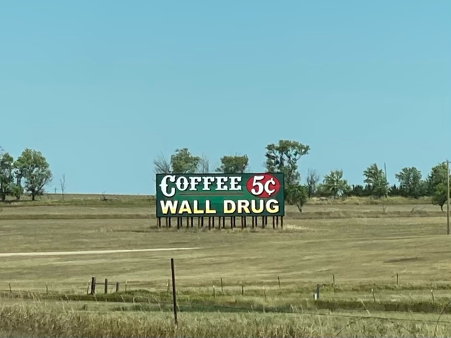
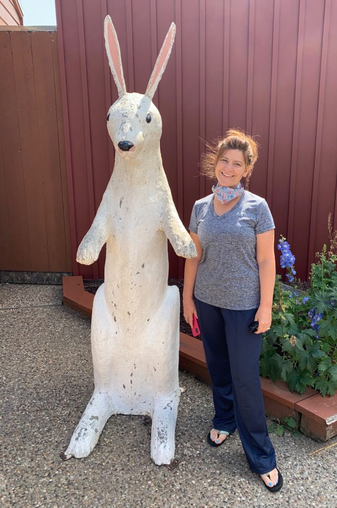
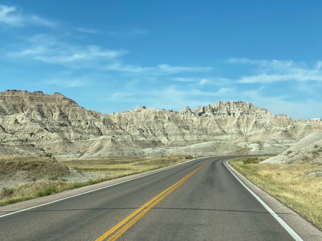
We were planning to return to Billings to spend the weekend with my brother when we heard that he’d gotten a better offer so we made a quick change in plans and decided to check out the South Dakota Badlands. We drove through Keystone, popped into Rapid City for a quick lunch and made a bee-line for the Badlands. From Rapid City to the Badlands is 53 miles of unremarkable road (Hwy 90 east), except for the incredible number of signs for the infamous Wall Drug along the entire route spaced no more than half a mile apart! Curiosity killed the cat and the myriad of unique signs for Wall Drug will drag you in. At Wall Drug you’ve hit the tourist shop motherload! Inside the multiple buildings that make up Wall Drug, you can get your free ice water, 5 cent coffee, or have a meal inside surrounded by over 300 original western oil paintings. If food’s not on your agenda, head to “the backyard” to have your picture taken on a saddled jackalope, pan for gold, check out thousands of historical photos, and witness children scared by an animated T-Rex. Finish the day buying some holiday ornaments, moccasins, homemade donuts, collectible spoons, or toothpaste…yup…it’s all here at Wall Drug.


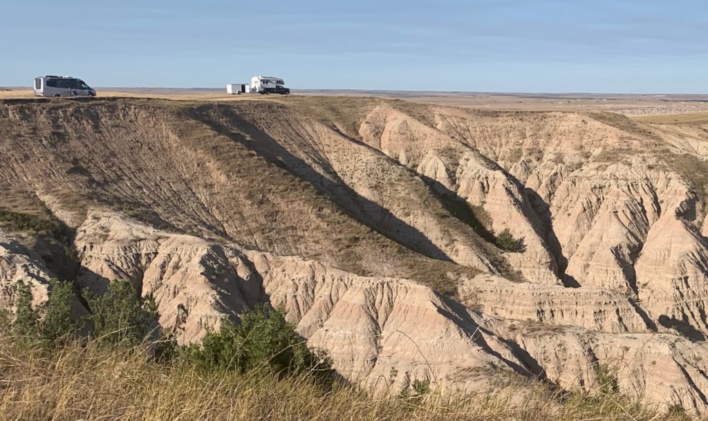
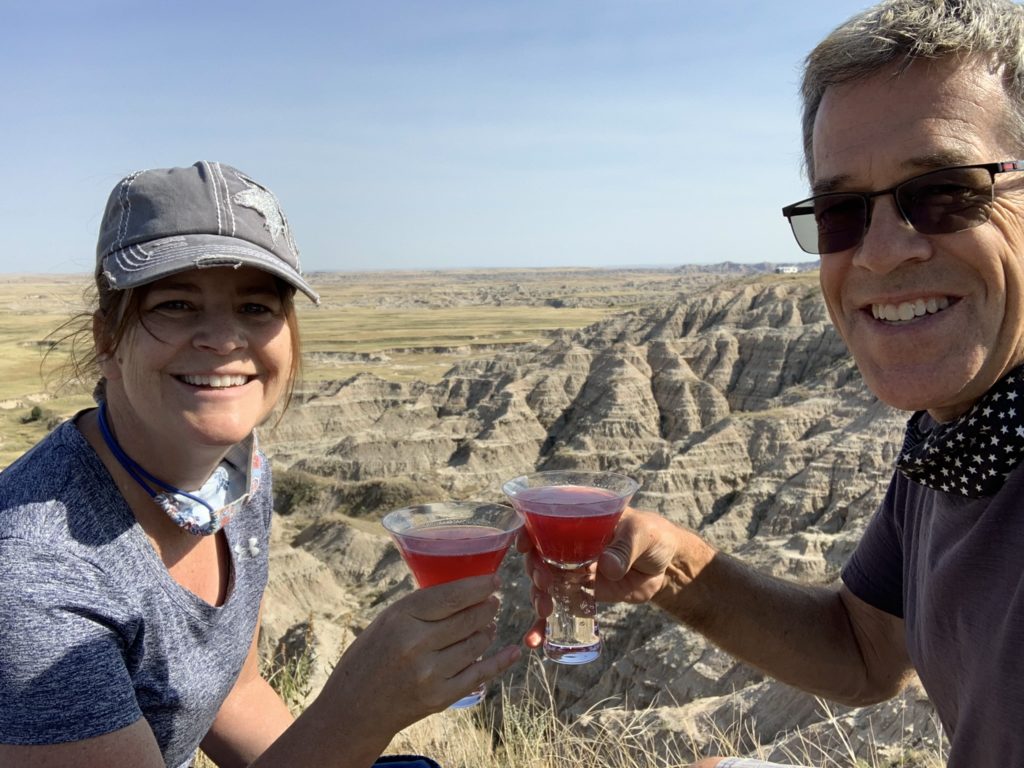
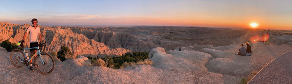
Our destination for that evening was a boondocking spot just a few miles to the south of the town of Wall before the west entrance to the Badlands National Park. We worked our way down some deeply rutted dirt roads to a dramatic spot overlooking the northern edge of the badlands. My cosmo went perfectly with the pretty sunset. Doug of course rode his bike into the park to see the sunset at Pinnacle Overlook and was rewarded with dramatic lighting at the overlook and a bright orange sunset on the ride back that he enjoyed with this bison.
DAY 4:
- Notch Trail hike in SD Badlands
- Panorama Point view in SD Badlands
- Yellow Mounds Overlook view in SD Badlands
- Pinnacles Overlook view in SD Badlands
- Roberts Prairie Dog Town visit in SD Badlands
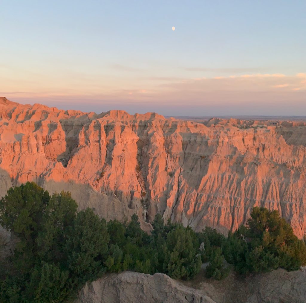
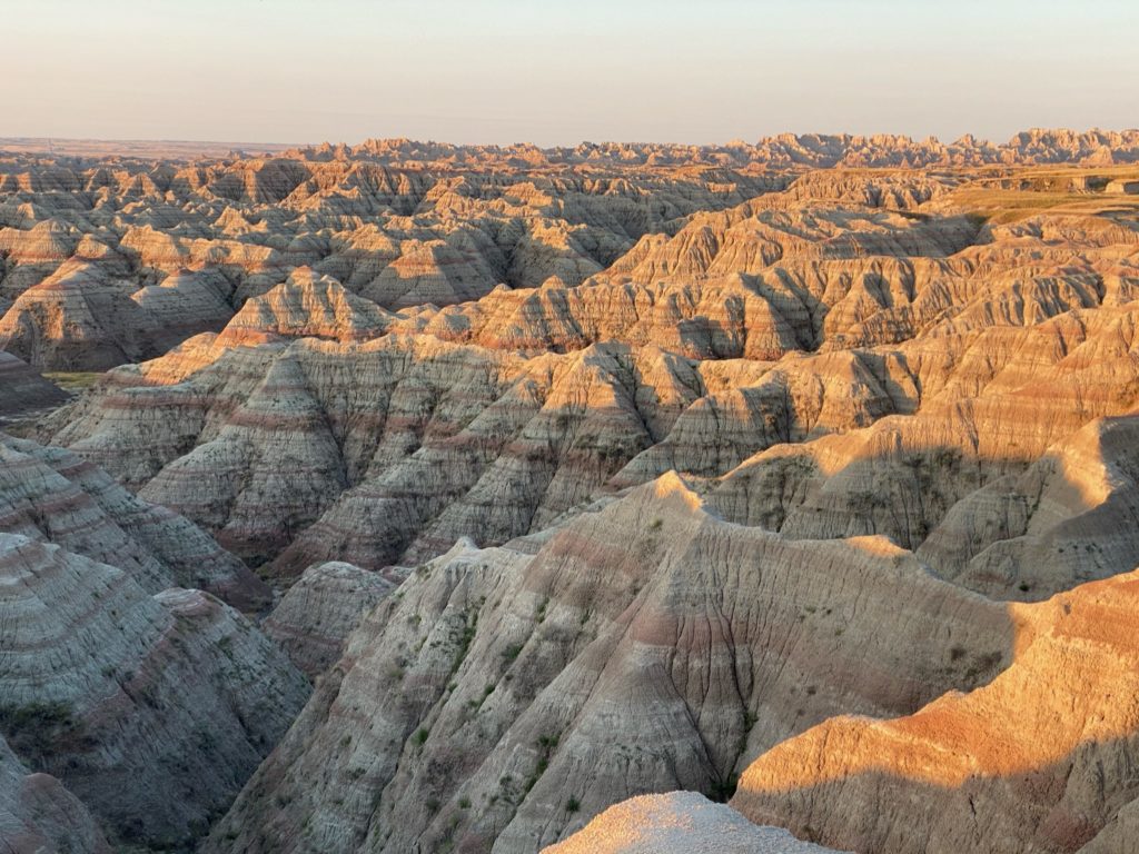
We got up early- before sunrise- as we wanted to see the morning colors wash across the badland rocks at the eastern entrance to the park. As we did our best to stealthily sneak past other boondockers, I looked over to see a women in her nightgown chasing after us to tell us we were dragging the dog leash alongside the RV! Don’t worry this wasn’t a Chevy Chase “Vacation” moment, Bailey was safely inside the RV with us.
We’ve seen some pretty spectacular sunrises in our travels together but this was right up there…very memorable. The shadows and colors across the layers of rock did not disappoint.
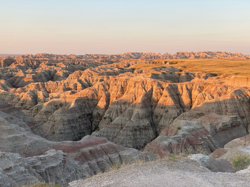
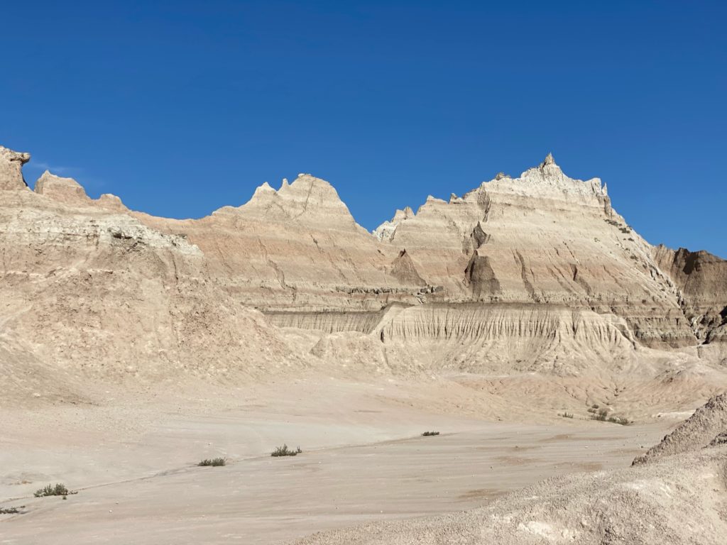
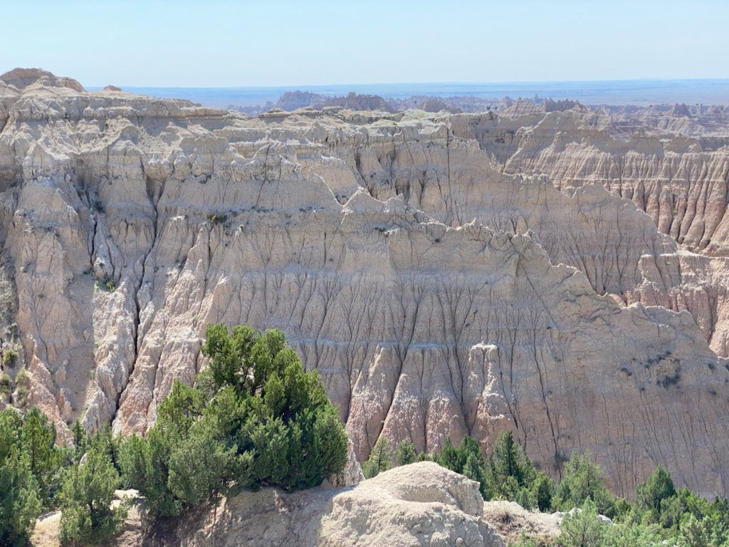
Our plan was to drive from the eastern end of the park to the western end and do a short hike or two along the way. This makes for a long day as without a single hike there are at least 10 pullouts that are worth a stop.
Our first stop was a parking lot leading to two different trailheads…both short and both worth it.
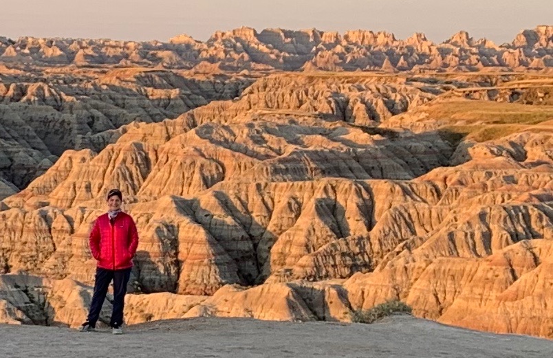
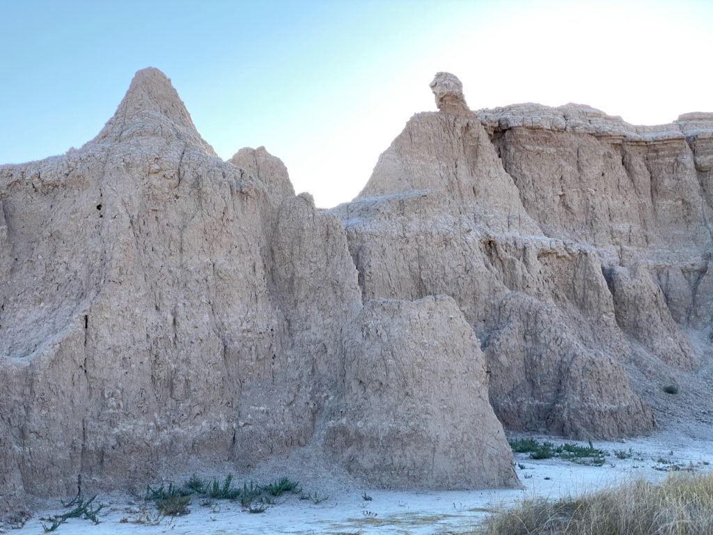
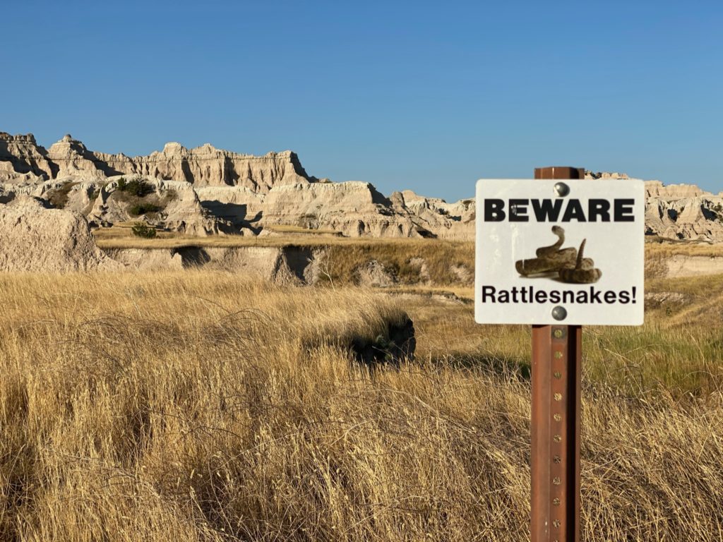
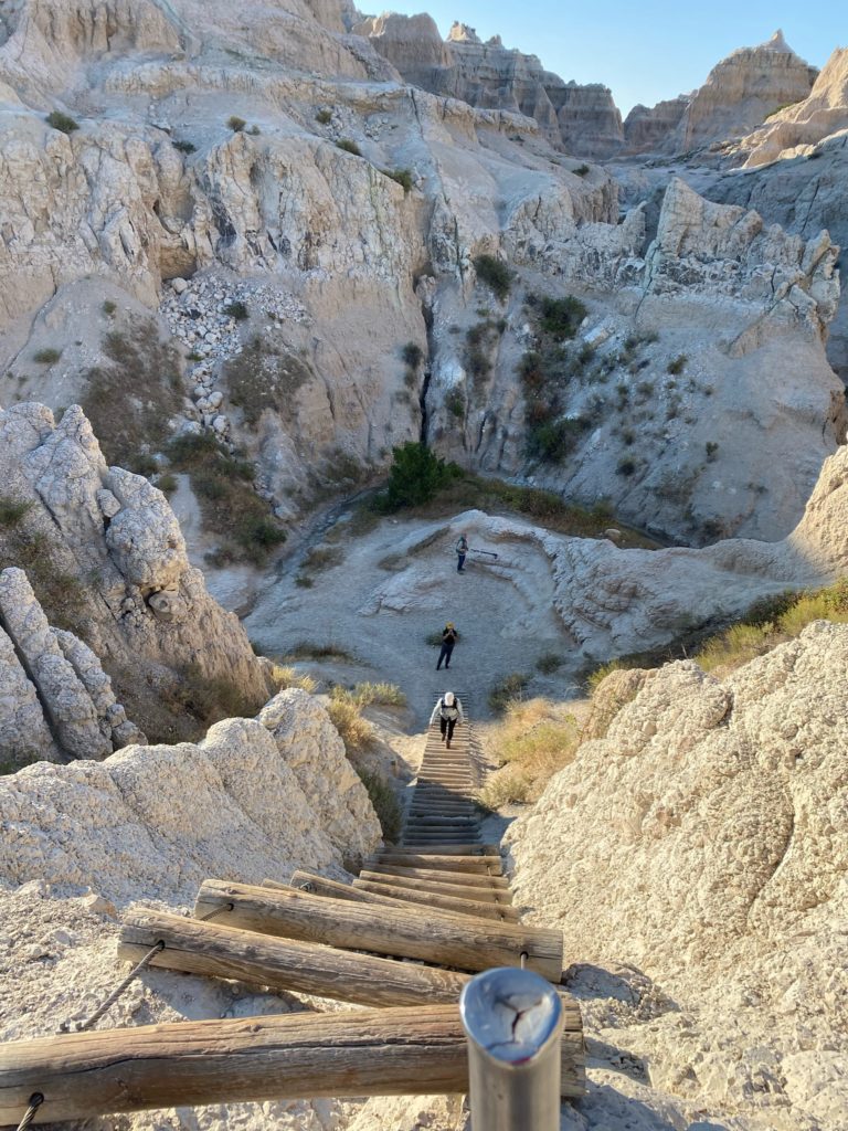
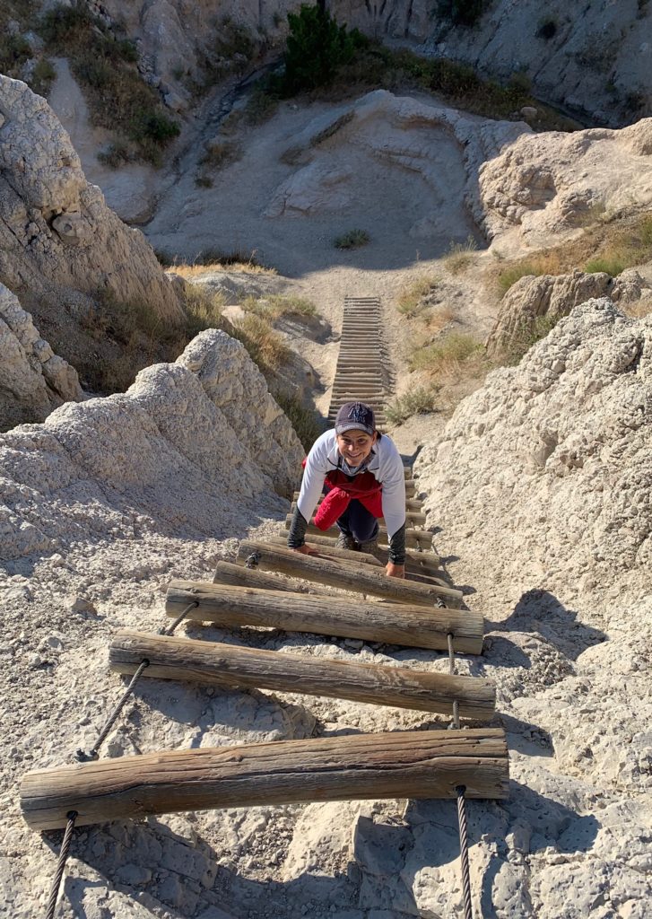
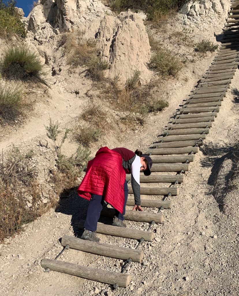
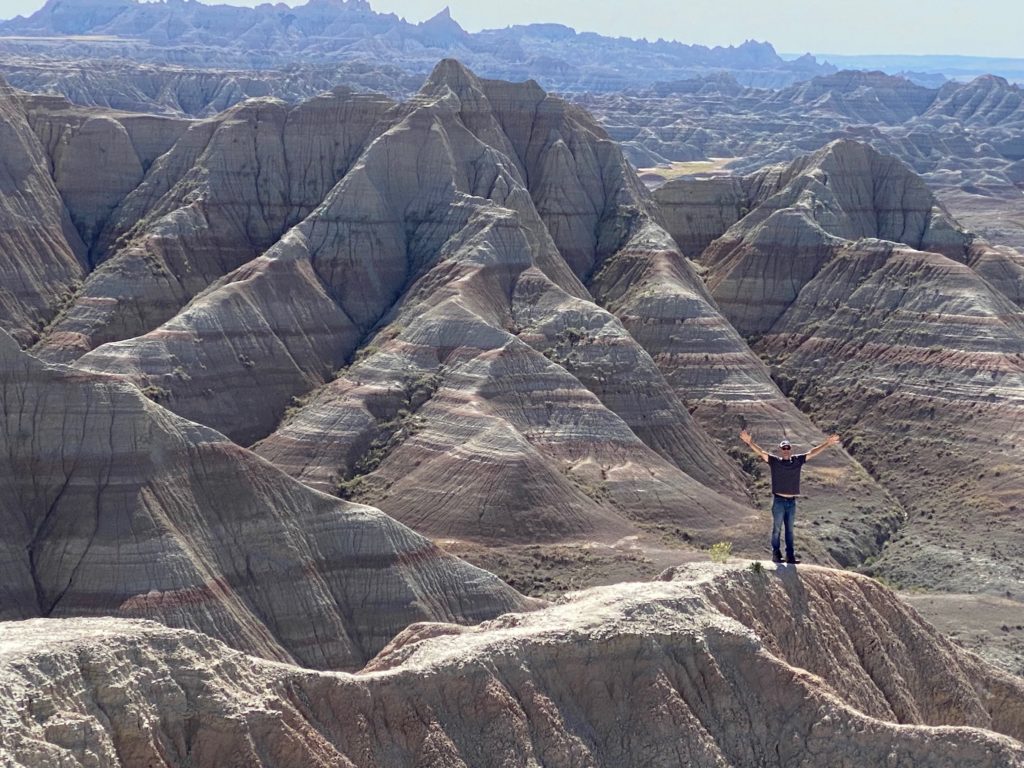
I didn’t love that the start of the third hike (Notch Trail) started with a huge warning about rattlesnakes but there are no dogs allowed so I knew at least one of us would likely survive to tell the story. This 1.5 mile out and back hike starts in a narrow canyon. About ½ way through this hike there’s a rope ladder to the top ledge and going up was really fun! The walk at the top ledge can be a bit unnerving if you have a fear of heights or falling but eventually the trail ends at a notch or saddle between two sandstone cliffs. The panoramic view across the badlands from this spot takes your breath away.
Getting back is far more challenging as the rocks can be slick and as you can see from the picture below I had no idea how much further I had to go down the wood/rope ladder and was actually nearly to the end and practically crawling on my hands and knees along the ground when Doug pointed out that it was probably safe to get off the ladder…embarrassing!
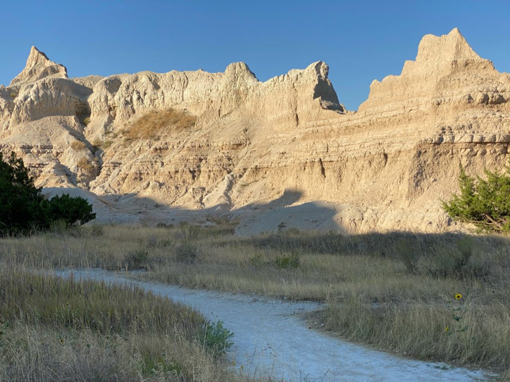
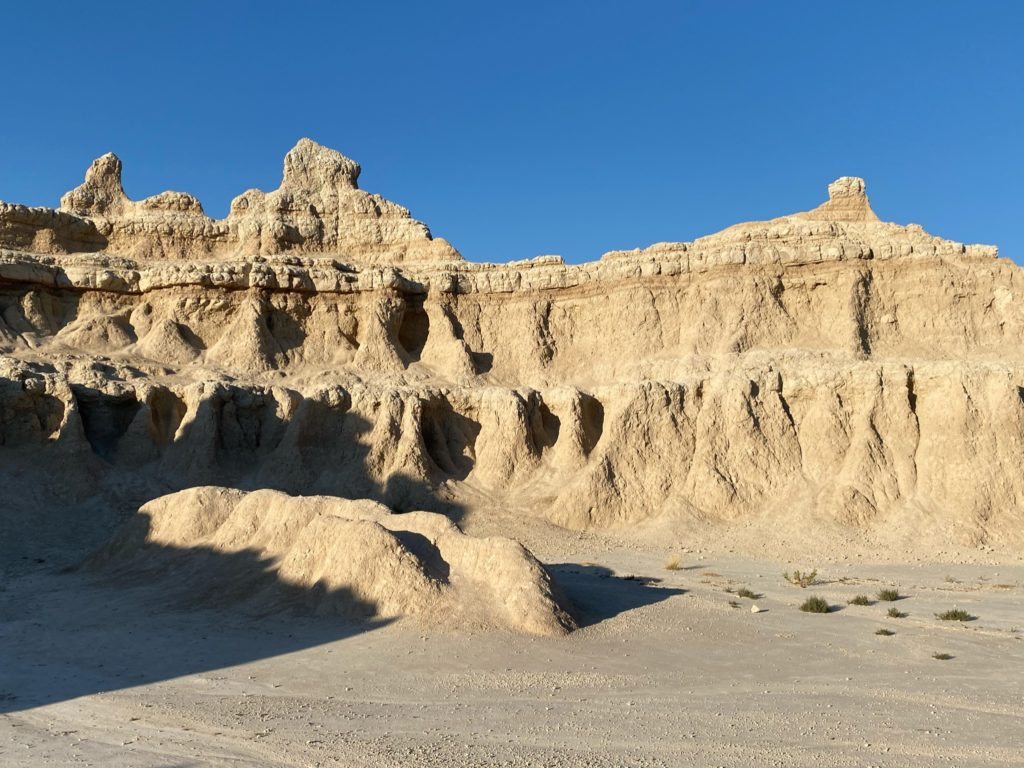
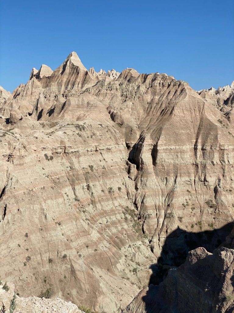
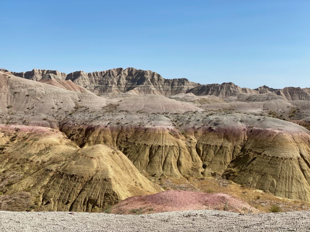
The route in this park is well planned and every stop along the way is otherworldly. Panorama Point, Yellow Mounds Overlook and Pinnacles Overlook were spectacular. Portions are beyond desolate, but the layers of rock and unusual formations are mesmerizing. I can’t imagine what settlers must have thought when they suddenly happened upon this geographical marvel. We loved every minute of it and can’t wait to go back so we can see and hike more in this area. Like all National Parks, dogs weren’t allowed on any trails so until our last stop, Bailey was not impressed.
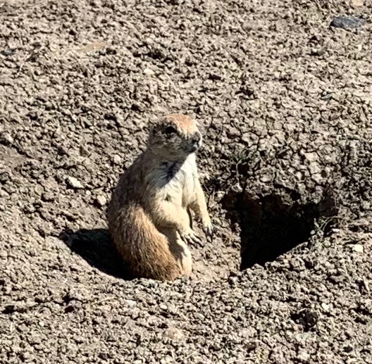
By late afternoon we arrive at the edge of the park and Roberts Prairie Dog Town. Sure, they’re rodents, but those barks are so funny and it was great to watch our dog watching the dogs. I have a former co-worker and friend named Alan, Alan, Al, Alan and Prairie Dogs always make me think of him because of the video below.
Doug had expertly maneuvered the RV in and out of pull outs all day so I volunteered to drive us back to Billings for a much needed respite. We were exhausted from the pace of this itinerary but still talk about the marvels of this area so if you’ve thought about doing it and haven’t yet, get out there!